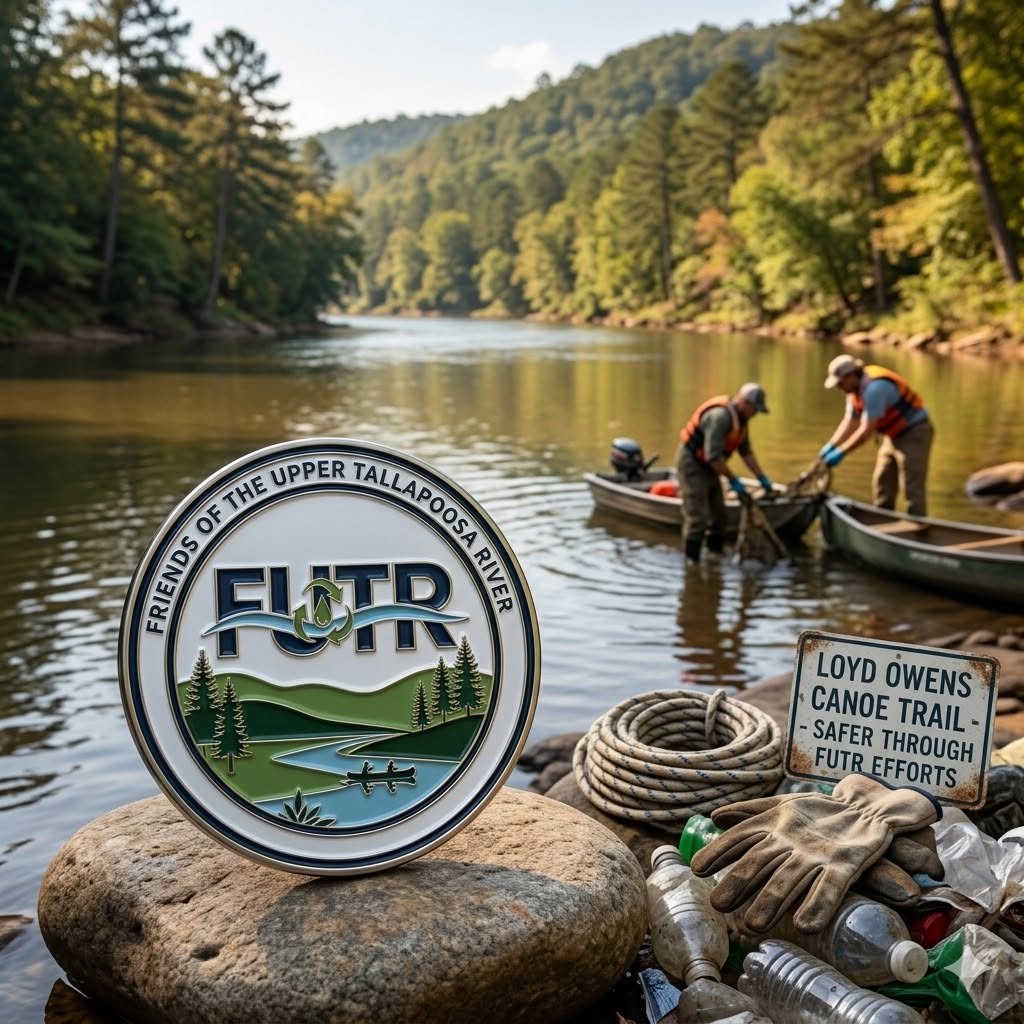
Friends of the Upper Tallapoosa River (FUTR)
Project Overview & Strategic Framework
The Friends of the Upper Tallapoosa River (FUTR) is a grassroots community initiative dedicated to the environmental stewardship, safety, and sustainable recreational development of the Upper Tallapoosa River corridor. Operating as a targeted division within the larger Tallapoosa Coalition, FUTR serves as a collaborative vehicle uniting local municipalities, non-profit organizations, landowners, and volunteers. The group’s foundational objective is to protect the river’s natural resources while managing its growing footprint as a premier regional eco-tourism and recreational asset.
Geographic Scope & Jurisdictional Focus
The direct focus area for FUTR spans the upper stretch of the river, originating at the Georgia-Alabama state line and extending downstream to the R.L. Harris Dam. This critical corridor impacts Cleburne and Randolph, with the coalition spanning into Chambers, Tallapoosa, and Elmore, and serves as a vital hydrological and economic lifeline for neighboring communities, small businesses, and outdoor enthusiasts.
Core Mission & Future Vision
FUTR operates under a community-led model designed to scale over time. The group coordinates immediate localized improvements while building the organizational capacity, data baselines, and regional partnerships required to eventually transition into a full-fledged, accredited Tallapoosa Riverkeeper program protecting the entire river basin.
Strategic Pillars & Volunteer Initiatives
To achieve its goals, FUTR organizes volunteer-driven and partner-backed initiatives across five core functional areas:
1. Environmental Protection & Watershed Stewardship
- Active River Cleanups: Organizing regular volunteer workdays to remove debris and litter from the water and shorelines, preserving the natural beauty and ecological integrity of the river corridor.
- Citizen-Science Monitoring: Deploying certified water quality testers to establish a consistent ecological baseline, utilizing specialized testing kits to actively track the long-term health of the watershed.
- Bank Stabilization: Partnering on low-impact engineering projects to execute extensive bank stabilization and erosion control, preventing loose soil from degrading the aquatic habitat.
2. Infrastructure Expansion & Recreational Access
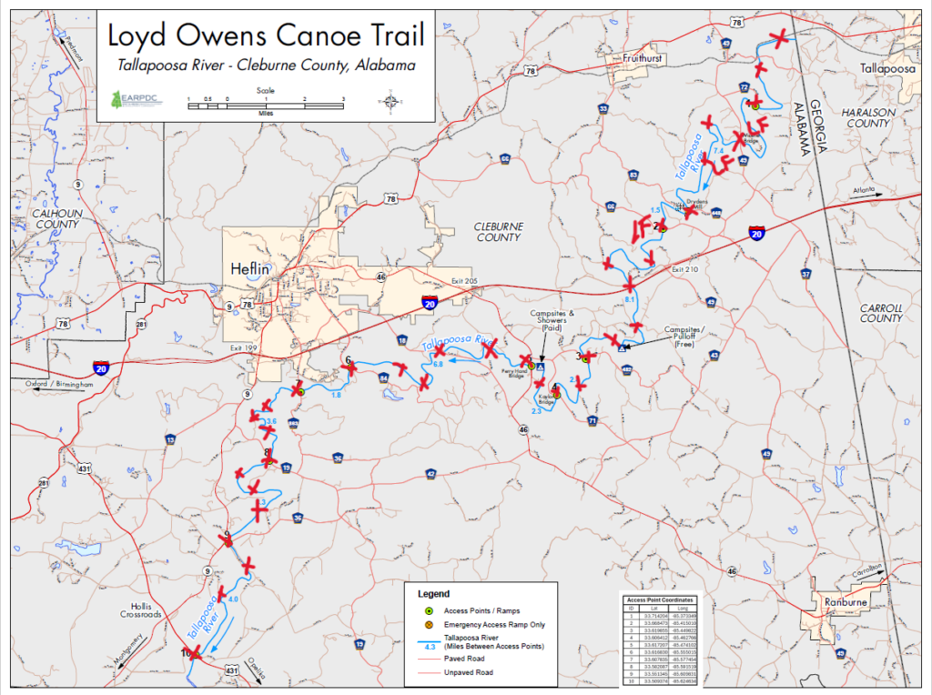
- Launch Site Revitalization: Improving, clearing, and maintaining public river access points along the Loyd Owens Canoe Trail, 40 miles of vital blueway, with a goal to ensure the 10 launch sites are safe, functional, and accessible for paddlers of all skill levels.
- Connectivity Goals: Working to systematically upgrade degraded or unusable access points, expanding the trail’s overall usable infrastructure to absorb high-traffic paddle sports and eco-tourism sustainably.
3. Public Safety & Trail Navigation
- Uniform River Marking: Installing and maintaining a comprehensive network of official directional markers and emergency mile-marker assets across targeted river locations to ensure clear navigation and rapid emergency response coordinates.
- Safety Assessments: Monitoring physical river hazards to mitigate risks for recreational boaters, kayakers, and anglers.
4. Education & Community Engagement
- Landowner Outreach: Engaging and educating local riverfront landowners on best management practices for conservation, riparian zone protection, and private property rights.
- Leave No Trace (LNT) Campaigns: Promoting environmental stewardship principles to the public through educational displays, sign installations at high-traffic access points, and community workshops.
5. Workforce Development & Community Inclusion
- Stewardship Field Training: Providing hands-on, specialized field training to local volunteers in watershed conservation and technical data collection.
- Collaborative Labor Partnerships: Working alongside regional partners—including the Tallapoosa Watershed Coalition based in Opelika, local Soil & Water Conservation Districts (SWCD), and county work-detail crews—to provide practical construction and land-clearing field experience to participants in restorative community labor programs.
Key Coalition Partners
FUTR’s success relies on a integrated network of stakeholders who align resources for the river’s future, including:
- Tallapoosa Watershed Coalition (Opelika)
- Cleburne County Commission & local municipalities
- Cleburne County Soil & Water Conservation District (SWCD) & Alabama Extension
- Alabama Scenic River Trail
- Volunteer Fire Departments
Stay Connected
Friends of the Upper Tallapoosa River Facebook Group